South Bay, 10,000 years to now
The History of Chula Vista
Chula Vista began as Kumeyaay ground, became a 26,632-acre Mexican land grant, and was invented as a town in 1888 by a Boston-backed land company that needed somewhere to sell orchard lots once Sweetwater Dam made irrigation possible. Lemons paid for the first fifty years, Rohr Aircraft paid for the next fifty, and master-planned Otay Ranch paid for the last thirty. The bayfront that industry claimed in the 1950s was handed back to the city in 2013 with one implosion.
Quick facts
- Founded
- 1888
- The San Diego Land and Town Company platted the Chula Vista subdivision on 5,000 acres carved out of Rancho de la Nación.
- Incorporated
- October 17, 1911
- Chula Vista became San Diego County's second incorporated city. State incorporation records also carry a November 28, 1911 filing date.
- The name
- Spanish for "pretty view"
- Chosen by the land company's promoters to sell a hillside subdivision looking west across San Diego Bay.
- What built it
- Lemons, then aircraft
- From the 1890s to the 1940s this was billed as the lemon capital of the world. Rohr Aircraft, founded 1940, replaced the groves with payroll.
- Water first
- Sweetwater Dam, 1888
- Finished April 7, 1888 and briefly the tallest masonry arch dam in the country. Without it there is no irrigated South Bay.
- Today
- 275,487 residents
- 2020 census count across 52 square miles — second-largest city in San Diego County, 15th largest in California.
Nine eras that made Chula Vista
Before 1769
Kumeyaay ground, not empty ground
The mesas between the Sweetwater and Otay rivers were Kumeyaay land — 'Iipai to the north, Tiipai to the south, later lumped together by the Spanish as "Diegueño." Archaeologists working the South Bay trace ancestral occupation back roughly ten thousand years, to a coastline that sat well west of today's bayfront. This was not a wilderness passed through but a managed landscape: estuary shellfish beds at the river mouths, acorn and grass-seed harvests on the mesas, controlled burning to keep the chaparral productive. The two river valleys that later determined where every freeway and reservoir went were the same corridors Kumeyaay families used to move between the bay and the backcountry. The Kumeyaay are still here, in twelve federally recognized bands across San Diego County.
- 'Iipai-Tiipai (Kumeyaay)
- ~10,000 years of occupation
- Sweetwater & Otay river corridors
1769–1868
Mission, then Rancho de la Nación
Spanish colonization out of Mission San Diego de Alcalá pulled the South Bay into a grazing economy, and Mexican independence turned that grazing land into private property. In 1845 Governor Pío Pico granted the 26,632-acre Rancho de la Nación to John Forster — a single title covering what is now National City, Chula Vista, Bonita and the western Sweetwater Valley. Cattle, not crops, paid for it; there was no reliable irrigation and no town. American annexation in 1848 left the grant intact but changed who could buy it, and in 1868 the Kimball brothers — Frank, Warren and Levi — bought the whole rancho. Frank Kimball surveyed it that year and started selling lots, and every straight north-south road in the South Bay is downstream of that survey.
- 1845 grant to John Forster
- 26,632 acres
- Kimball brothers buy in 1868
1886–1900
A railroad deal invents the town
Frank Kimball wanted the transcontinental railroad, and he paid for it in land — ceding roughly 15,000 acres to a Boston syndicate that formed the San Diego Land and Town Company in 1886 to make the California Southern worth building. Company manager William Dickinson set aside about 5,000 acres south of the Sweetwater Valley for a subdivision and named it Chula Vista. Nothing there could be farmed without water, so the same interests built Sweetwater Dam: construction began November 17, 1886 and finished April 7, 1888, creating the reservoir that still supplies the South Bay. The 1888 subdivision map sold five-acre parcels to buyers who were expected to plant orchards, and by that year roughly a hundred houses were going up at once. The National City & Otay Railway had already begun running through in 1887.
- San Diego Land and Town Co., 1886
- Sweetwater Dam finished April 7, 1888
- 5-acre orchard lots
1890s–1940s
Lemon capital of the world
The five-acre parcels worked. Chula Vista's frost-free coastal shelf turned out to be close to ideal for lemons, which unlike oranges could be picked nearly year-round and stored, and by the early twentieth century the town was marketing itself as the lemon capital of the world. Packing houses clustered near the rail line, seasonal labor filled the groves, and the fruit went out by refrigerated car to the East Coast. The city incorporated on October 17, 1911 with a population in the hundreds — a farm town with a downtown at Third Avenue and F Street and a civic identity built on citrus. Japanese American families were among the growers and laborers who made the industry work, and their forced removal during World War II is part of the same story. Lemons faded after the war, beaten by land prices and cheaper inland acreage, not by frost.
- Incorporated October 17, 1911
- Lemon industry c. 1890–1960
- Packing houses along the rail line
1940–1959
Fred Rohr turns a farm town into a factory town
Fred Rohr had helped fabricate the fuel tanks for the Spirit of St. Louis at Ryan; in 1940 he opened Rohr Aircraft Corporation on former farmland in Chula Vista. His idea was the "power package" — a complete engine assembly delivered ready to bolt onto an airframe — and it made Rohr the world's biggest supplier of them. The plant went from a handful of buildings in 1941 to thousands of workers, many of them women, during the war. The city's population multiplied, housing went up faster than the city could annex it, and lemon groves started converting to subdivisions. The postwar decades locked in the pattern: aerospace payroll, tract housing east of the old downtown, and a shopping-center economy that started pulling retail away from Third Avenue by the end of the 1950s.
- Rohr Aircraft founded 1940
- "Power package" assemblies
- Wartime population boom
1960–1984
Freeways, malls and a downtown that had to fight
Interstate 5 pinned the city against the bay, Interstate 805 cut a second north-south line through what had been lemon terraces, and the enclosed Chula Vista shopping center opened at the start of the 1960s a few blocks from Third Avenue. The combination did what it did everywhere: shoppers followed parking, and the historic main street lost its anchor tenants. Third Avenue's response was slow and stubborn rather than dramatic — merchant associations, streetscape work, and eventually the district identity that is marketed today as Third Avenue Village. Meanwhile the industrial bayfront filled in, with the South Bay Power Plant burning fuel oil on the water's edge from the late 1950s onward. The Vogue Theatre, open on Third Avenue since January 19, 1945, kept running through the whole stretch.
- I-5 and I-805 built through the city
- Mall opens c. 1960–62
- Third Avenue merchant revival
1985–1999
The city doubles east
In November 1985 voters approved annexing Montgomery — roughly 2,300 acres of unincorporated South Bay between the freeways — the largest single addition to a city the region had seen, finalized at the start of 1986. In the same window EastLake Development broke ground on a 3,000-acre master-planned community east of I-805, and in January 1989 the Baldwin Company bought the 19,600-acre Otay Ranch for $150 million, with the joint city-county Otay Ranch plan adopted in 1994. Chula Vista stopped being a bayfront town with hills behind it and became a city whose center of population moved steadily east. The Chula Vista Nature Interpretive Center opened on the Sweetwater Marsh in 1987, the Olympic Training Center opened in 1995 on land donated by EastLake, and Coors Amphitheatre opened in 1998.
- Montgomery annexation, Nov 1985
- Otay Ranch bought 1989 for $150M
- Olympic Training Center, 1995
2000–2019
The power plant comes down
The defining Chula Vista event of this stretch was a subtraction. The South Bay Power Plant, which had shaped the waterfront for half a century, was decommissioned and imploded on February 2, 2013, clearing the way for a bayfront plan the city and the Port had been arguing over for decades. The Vogue Theatre had already gone dark in July 2006 after 61 years. The nature center was rebranded the Living Coast Discovery Center in 2012. Park View Little League won the Little League World Series on August 30, 2009, the first San Diego County team to do it in more than forty years, and for a week the city was on national television for something other than the border. The Olympic Training Center became the Chula Vista Elite Athlete Training Center under new operators in 2017.
- Park View wins LLWS, Aug 30, 2009
- Power plant imploded Feb 2, 2013
- Living Coast rebrand, 2012
2020–today
A resort city on a working bay
Otay Ranch and Millenia kept building out, the university-innovation site kept being planned, and the bayfront finally moved from renderings to concrete. The Gaylord Pacific Resort and Convention Center opened May 15, 2025 — 1,600 rooms, roughly $1.3 billion, the largest hotel in California and Gaylord's first in the state — on the ground the power plant used to occupy. It is the biggest single change to Chula Vista's waterfront since the 1950s, and it arrives in a city that is now majority Latino, deeply cross-border, and larger than most people outside San Diego County realize. What happens to Third Avenue and the older west side as the money lands on the bay is the open question of this decade.
- Gaylord Pacific opened May 15, 2025
- Largest hotel in California
- Bayfront built on the plant site
Lost landmarks
Seven Chula Vista places that were real, mattered, and are gone — or gone as the thing they used to be.
South Bay Power Plant
late 1950s–2013
Four stacks on the edge of San Diego Bay burned fuel oil and gas for half a century and were visible from most of western Chula Vista. Its lease and emissions made it the single most contested structure in the city, and its retirement was the precondition for every bayfront plan on the books. It was imploded on February 2, 2013. The site is not a ruin — it is the parkland and resort district you can walk today, which is the only trace it leaves.
The Vogue Theatre
1945–2006
A Streamline Moderne single-screen house at 226 Third Avenue designed by architect Frank Hope Jr., opened January 19, 1945 and dark since July 2006. For six decades it was downtown's anchor after sundown, and its closure marked the low point of Third Avenue's post-mall decline. The building itself still stands with its marquee frame intact, and the city has moved to acquire and revive it — a lost institution rather than a lost structure.
The lemon packing houses
c. 1890s–1950s
The industry that gave Chula Vista its first identity ran on packing sheds sited next to the rail line, where fruit was graded, wrapped and loaded into refrigerated cars. They employed a large share of the town each season and set the rhythm of the year. Land value, not competition, killed them: the same flat rail-adjacent parcels were worth far more as industrial and commercial ground after the war. The street grid and the rail alignment through the west side are the clearest surviving trace.
The lemon groves themselves
c. 1890s–1960s
Terraced groves once covered the slopes now occupied by I-805 and the neighborhoods either side of it — historians of the industry point specifically to hillside plantings replaced by the freeway. They disappeared parcel by parcel rather than all at once, as growers took subdivision offers through the 1950s. Look for the odd surviving mature citrus in older west-side yards, and for street and school names that still carry the orchard vocabulary.
Rancho de la Nación as one place
1845–1868
For twenty-three years, National City, Chula Vista, Bonita and the west Sweetwater Valley were a single 26,632-acre property granted to John Forster. It vanished as a unit when the Kimball brothers bought it in 1868 and immediately began surveying and selling it off. Nothing of the rancho operation survives above ground here, but its boundaries and Frank Kimball's 1868 survey lines are still legible in the region's road grid, and the San Diego History Center holds the Rancho de la Nación collection.
The original downtown retail core
c. 1911–1970s
Before the enclosed mall, Third Avenue between E and H was where the city bought hardware, groceries, clothes and drugs, with the county's farm economy feeding it. The shopping center that opened a few blocks away at the turn of the 1960s took the anchor tenants and the parking-oriented traffic with it. The buildings largely survive at their original scale, which is why the district reads as a real main street today — the loss was the tenant mix, not the fabric.
The pre-1985 Montgomery
c. 1900s–1986
Montgomery was an unincorporated South Bay community of roughly 2,300 acres with its own identity, wedged between I-5 and I-805 around Main and L streets, historically underserved on streets, lighting and sewers because it sat outside any city. Voters approved annexation to Chula Vista in November 1985 and it was folded in at the start of 1986. The name survives on schools, a fire station and local usage, and the infrastructure gap it inherited is still visible block to block.
Still standing
Chula Vista is not a preservation showpiece — it lost most of its nineteenth-century fabric to orchards, then lost the orchards to subdivisions. What survives survives because it is still being used: a dam that still holds water, a main street that still sells dinner, a clubhouse that still hosts meetings, a training center that still has athletes on the track. Ten places you can actually go.
Sweetwater Dam
built 1886–1888
The masonry arch dam that made irrigated agriculture possible in the South Bay, completed April 7, 1888 and once the tallest of its type in the United States. It is an ASCE historic civil engineering landmark and still part of the working water system. Views are from the surrounding Sweetwater Regional Park roads and trails rather than the structure itself.
Third Avenue Village
core buildings c. 1910s–1950s
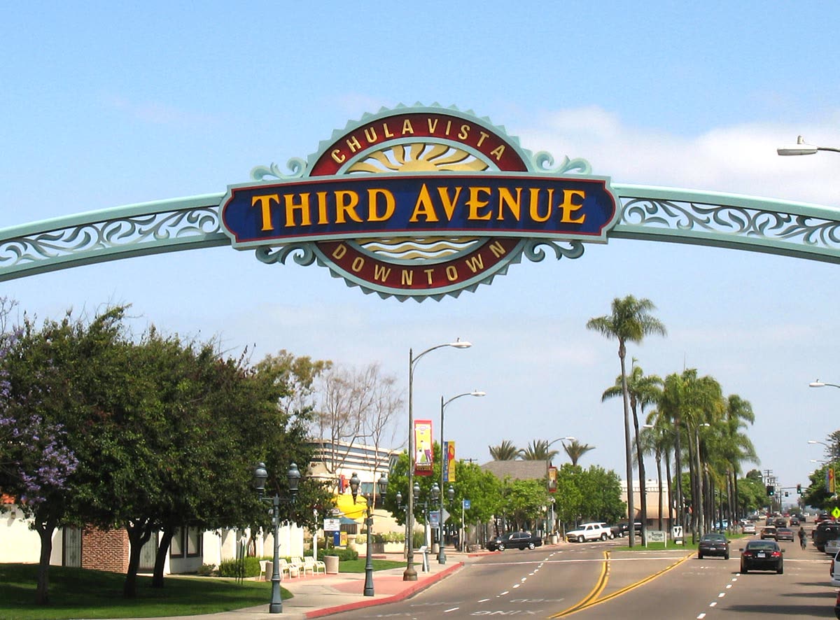
The historic main street between E and H, still at its original one- and two-story scale, now the city's densest concentration of independent restaurants, taquerias and bars. It is where the Lemon Festival runs each summer, which is the closest thing Chula Vista has to a civic history ritual. Freely walkable, and the single best place to read the pre-freeway city.
The Vogue Theatre building
built 1945
Frank Hope Jr.'s Streamline Moderne theater at 226 Third Avenue is closed but standing, its curved facade and marquee structure still defining that block. The city has pursued acquisition with the aim of bringing it back as a venue. For now it is an exterior you can photograph, not an interior you can enter.
Greg Rogers House ("Bay Breeze")
built 1910
The home of an early Chula Vista civic figure and the city's designated Historic Site No. 1, moved in 1985 from E Street to 616 Second Avenue to save it. It is a rare intact example of the pre-boom residential city. Viewable from the street; interior access depends on events.
Chula Vista Woman's Club
clubhouse built c. 1926–1928
The club organized in 1913 and its clubhouse is a designated city historic site, still in use for meetings, rentals and community events rather than sitting as a museum piece. Sources differ on the build year — the city lists 1926, the club lists 1928. It is one of the few civic buildings in Chula Vista that has done the same job for a century.
San Diego Country Club
founded 1897, Chula Vista course from 1920
The club dates to 1897 in what is now Balboa Park, moved to Point Loma, then settled on its 160-acre Chula Vista site around 1920 with a course laid out by William Watson. Its mature trees and street-facing edges shape the whole neighborhood around Hilltop and Naples. Private club — the streetscape is the public part.
Living Coast Discovery Center
opened 1987
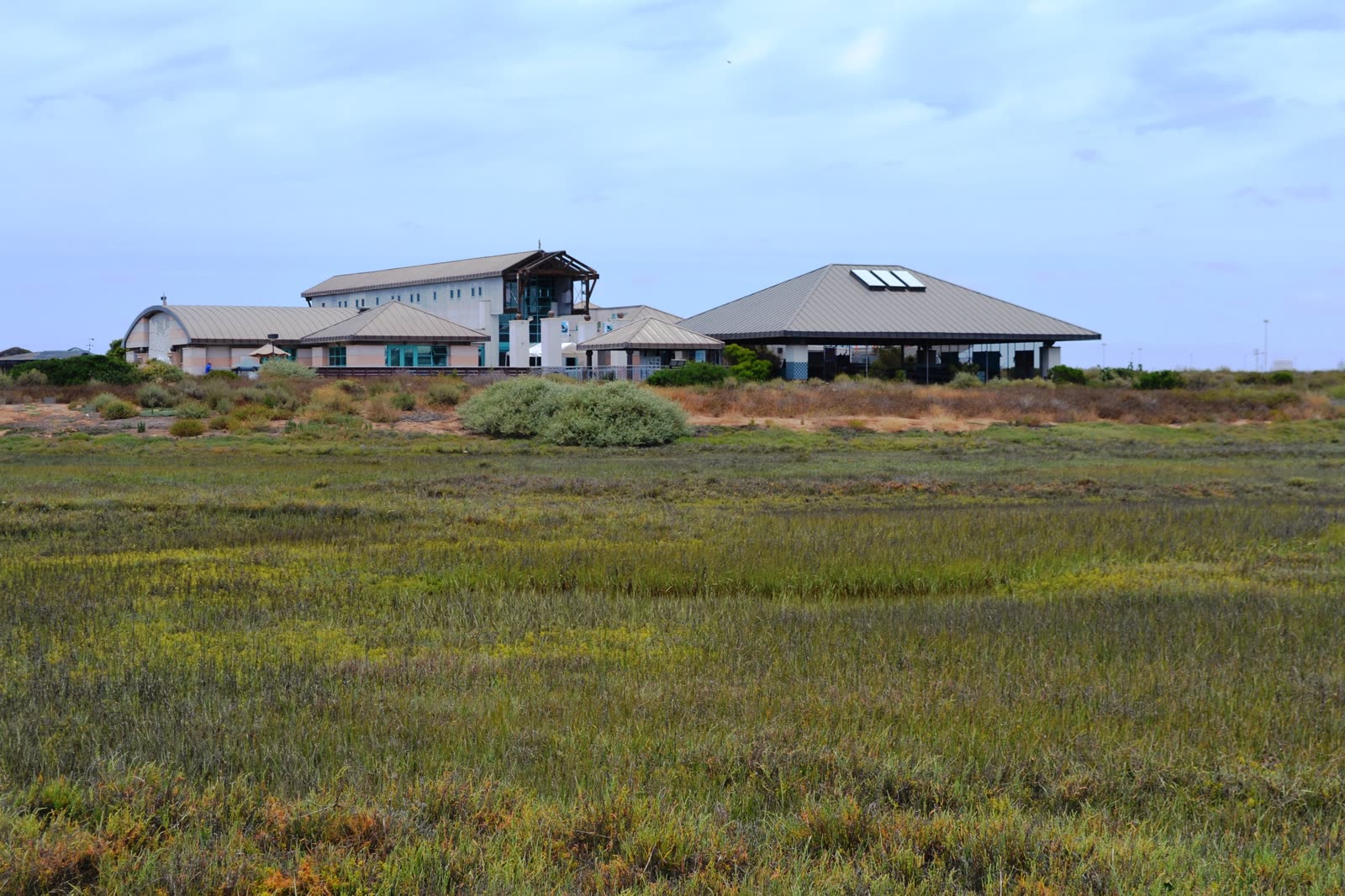
Built on the Sweetwater Marsh as the Chula Vista Nature Interpretive Center and renamed the Living Coast Discovery Center in 2012, with a 2006 addition. It sits in a national wildlife refuge, which is why you reach it by shuttle rather than driving to the door. Open to the public and the best introduction to what the bay looked like before fill and industry.
Chula Vista Heritage Museum
in the Civic Center library, opened 1976
A small local-history exhibit space inside the Civic Center branch of the Chula Vista Public Library, with rotating shows on the lemon era, Rohr, and Kumeyaay history in the South Bay. It is free, it is staffed by people who know the primary sources, and it is where to start if you want to go deeper than any web page. Check current hours before going.
Chula Vista Elite Athlete Training Center
opened 1995
The 155-acre former U.S. Olympic Training Center, built on land donated by the EastLake developers and opened in 1995, now operating under the Elite Athlete Training Center name since 2017. Track, throws fields, archery ranges and the BMX supercross hill are all on one campus. Public tours run on a published schedule.
Bayfront parks and promenade
post-2013, on 1950s industrial ground
The waterfront paths, marina edges and new park space west of Marina Parkway sit on land the South Bay Power Plant and its infrastructure held until 2013. Standing there with the Gaylord Pacific tower behind you is the most direct way to see the industrial-to-resort turn the city just made. Free and open daily.
Watch: two long-form histories
San Diego Foundation
The History of Chula Vista (KUSI-TV)
A broadcast overview that runs the arc from the rancho and the land company through the lemon years and into the modern city. Good orientation before the longer material below.
tba46
Japanese American History in Chula Vista
A nineteen-minute local presentation on the Japanese American families who farmed and worked in Chula Vista, and what incarceration during World War II did to them and to the agricultural economy. This is the part of the lemon story most city summaries leave out.
What Chula Vista looked like a long time ago
The Old Timey Channel
Early 1970s drive through Chula Vista (8mm)
Fifteen minutes of home-movie footage shot from a car through Chula Vista in the early 1970s — Third Avenue, Broadway and the surrounding blocks before the eastern build-out. Storefronts, signage and traffic patterns that no photograph collection captures this plainly.
From the archives
Chula Vista in old photographs
These real-photo postcards of early Chula Vista are held by the San Diego History Center and published in its Chula Vista postcard collection. Reproduced here with credit; each photo links to the original scan. Dates on the cards are approximate.
Early 1900s
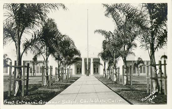
Front entrance, Chula Vista Grammar School
Newly planted palms line the walk to the grammar school's front doors, back when a single school building served the whole lemon town.
San Diego History Center, postcard PC9 — view original scan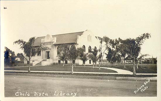
Early 1900s
Chula Vista Library
The town's first purpose-built library, a Mission Revival block sitting almost alone on a dirt-edged street with open fields behind it.
San Diego History Center, postcard PC9-1 — view original scan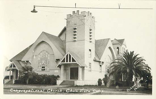
Early 1900s
Congregational Church
A wood-frame church with a square bell tower and a street lamp strung over the corner — one of the young city's first civic gathering places.
San Diego History Center, postcard PC9-2 — view original scan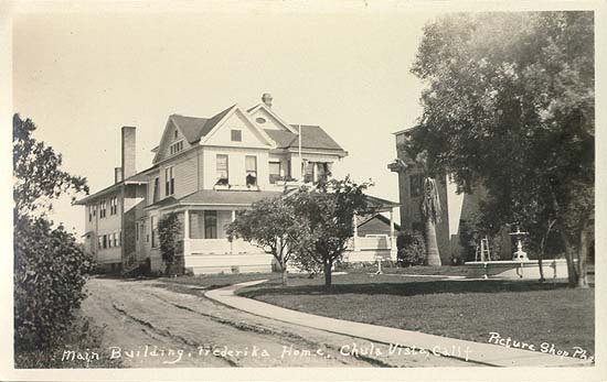
Early 1900s
Main building, Fredericka Home
The main house of the Fredericka Home for the aged, the retirement community that grew into today's Fredericka Manor, seen from an unpaved lane.
San Diego History Center, postcard PC9-5 — view original scan
Four moments, four clips
CBS 8 San Diego
Tour of Rohr, 1965
Newsreel footage from inside the Rohr Aircraft plant at its mid-century peak. It shows the scale of the operation that employed a large share of the city.
Port of San Diego
South Bay Power Plant Implosion
The February 2, 2013 implosion that removed the waterfront's defining structure. Everything currently being built on the bayfront starts with this thirty seconds.
G Cast
City of Chula Vista annexation of Montgomery (8mm)
Home footage from the mid-1980s around the Montgomery annexation, the largest single addition to the city. It shows the streets and storefronts that were being folded in.
George Lopez
George Lopez celebrates with the 2009 Little League World Champions
Park View Little League's 2009 title was the first for a San Diego County team in over forty years. This clip captures the national attention that followed the players home.
Notable people from Chula Vista
Fred Rohr
A sheet-metal fabricator who worked on the Spirit of St. Louis at Ryan before founding Rohr Aircraft Corporation in Chula Vista in 1940. His "power package" made the company the world's leading supplier of engine assemblies. No single person did more to convert Chula Vista from an agricultural town into an industrial one.
Frank Kimball
With his brothers Warren and Levi he bought all 26,632 acres of Rancho de la Nación in 1868, surveyed it, and traded roughly 15,000 acres to bring the railroad south. The subdivision that became Chula Vista exists because of that bargain. He is more associated with National City, but his survey drew the South Bay's grid.
Greg Rogers
An early twentieth-century Chula Vista civic leader whose 1910 house is the city's Historic Site No. 1 and whose name is on a west-side park and elementary school. He belongs to the generation that turned a land-company subdivision into an actual municipality after 1911.
Rey Mysterio
Óscar Gutiérrez, the WWE Hall of Fame luchador, is Chula Vista's most recognizable global export and has kept the city in his public identity throughout his career. In a border city where lucha libre is part of the cultural fabric, that association carries more weight than a typical celebrity hometown claim.
Jessica Sanchez
A Chula Vista native who finished runner-up on American Idol in 2012 as a teenager and won America's Got Talent in 2025. Her Filipino-Mexican background is a reasonable stand-in for the city's own demographic story over the last thirty years.
Mary Casillas Salas
Chula Vista's 40th mayor, serving 2014–2022 after time in the California State Assembly, and the first Latina to hold the office. Her tenure spans the bayfront agreements and the eastern build-out that define the city's current shape.
Walk it yourself
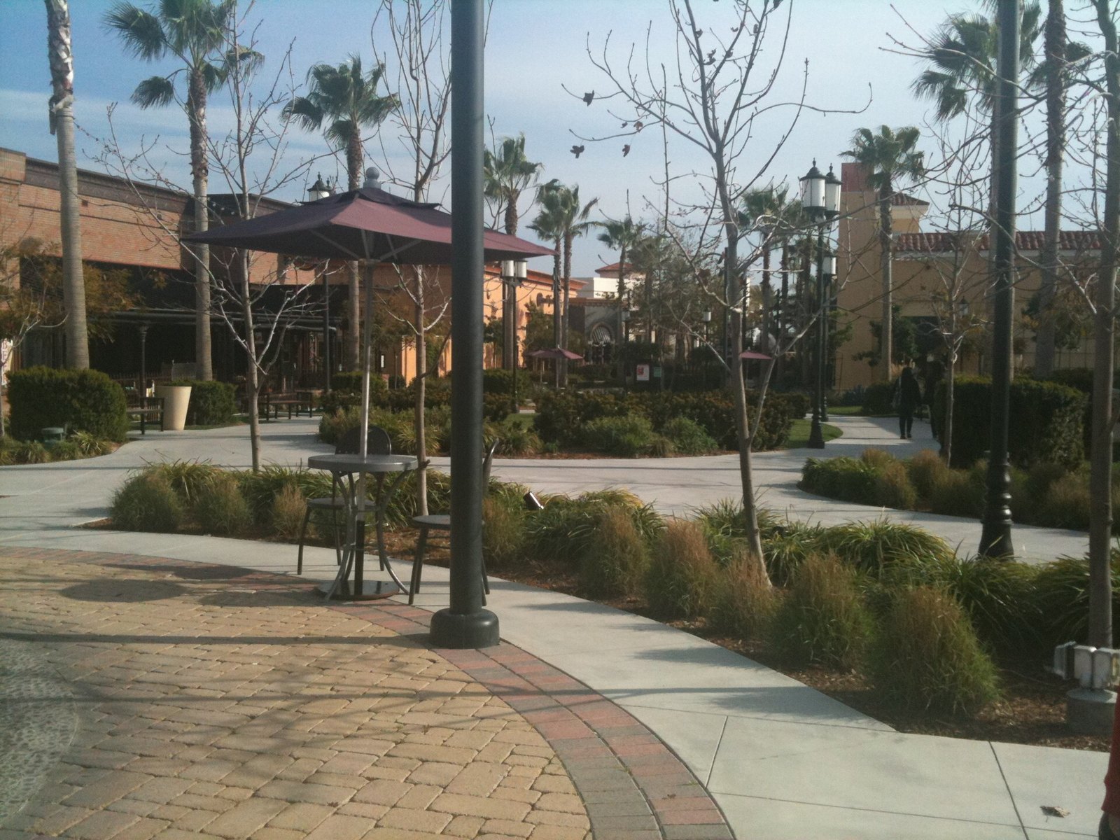
Start where the lemon town was: things to do in Chula Vista
Third Avenue, the bayfront and the parks that sit on former grove and industrial land.
See how annexation and Otay Ranch split the city: neighborhood guides
West side, Montgomery, Castle Park, EastLake and Otay Ranch, and what each era built there.
Read the longer local reporting: Chula Vista stories
In-depth guides on eating, moving here and understanding how the city actually works day to day.